

Apple Maps now provides indoor maps for eight additional airports in the United States, as the new feature continues to roll out in iOS 11.
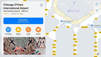
The recently added airports include O'Hare International and Midway International in Chicago, McCarran International in Las Vegas, Baltimore–Washington International, Miami International, Minneapolis–Saint Paul International, Oakland International, and Portland International.
The feature has also been available for Philadelphia International Airport and San Jose International Airport since iOS 11 was in beta.
When searching for these airports, Apple Maps users can tap "look inside" or simply zoom in to view terminals, boarding gates, security checkpoints, airline check-in desks, baggage claim carousels, information kiosks, restrooms, stores, restaurants, parking garages, and even escalators, elevators, and stairs.
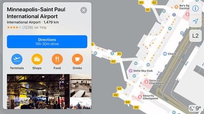
It is even possible to browse by floor, or search for shops, food, drinks, or restrooms in a specific terminal. Tapping on a restaurant, for example, brings up a detailed place card with photos, hours, and additional information.
Apple software engineering chief Craig Federighi previewed Apple's indoor maps at its Worldwide Developers Conference in June. Skip to around the 1:07:50 mark of Apple's WWDC 2017 keynote video to watch.
Watch on YouTube
















































Top Rated Comments
ATL is the world's busiest airport (and has been for several years now). If Apple wanted to make the airport mapping useful to a larger percentage of its user base, they would start with the airports that have the highest volume and work their way down to smaller airports.
Apple might eventually catch up with Google in the mapping department in 5 or 10 years. Until then, I guess I'll just keep using Google Maps (which has had ATL mapped in detail for several years now).